Mapping History: Yunnan Human Geography Through GIS Perspective
Digital Humanities Project (Sep 2024 – Jan 2025)
This project received the Digital Humanities Seed Funding, which is utilized for student recruitment.
Background photo: Aerial photo of Menghun(勐混坝子) Bazi. Photo by Wei Zhifei, 2025.
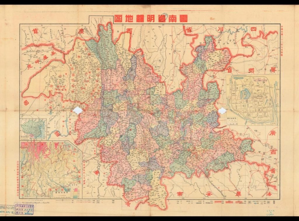
Map of Yunnan Province
Yunnan Geographical Society, 1939
The historical process of human settlements in the mountains, basins and valleys, which had been shaped by diverse migrations in history, including wars between China and Burma, the settlements of the military garrison system of the Guards (wei) and Battalions (suo) since the 15th century established by the Ming government, the collapse of the military garrison system, and the reforms of Apportioning the Poll Tax with the Land Tax (tan ding ru di) in the 1710s during the Qing dynasty, which drove waves of resettlements from the basins to the mountains for the exploitation of resources such as silver and copper mines, tea plantations, and long-distance trade between Yunnan and Burma.
About This Project
Led by Prof. Jianxiong Ma, this project aims to present the settlement patterns of the Han Chinese and indigenous ethnic minorities, as well as the migration history since the 15th century. We focus on the human settlement patterns around the Bazi Basin in the Yunnan and Guizhou Plateau, viewing this as a historical formation process influenced by the relocation of military garrisons and community organization reforms due to changes in national taxation policies.
In the first phase of this research project, we conducted a detailed study of local documents from the Wanli period and digitized these records. Next, we established a GIS system and input data on the Baziwei and post stations to identify the postal routes of that time. This analysis helps us explain human settlements and the construction of ethnic identity under the geographical conditions of that era, as well as the relationship between ecology, politics, ethnic identity, and culture in shaping the social landscape of the southwestern border of China.
GIS Technology
Geographic Information System (GIS) is a powerful technology that enables the capture, storage, management, analysis, and visualization of geographic data. Through GIS technology, we can achieve the following objectives:
- Data Integration and Visualization: By combining geographical information from historical documents with modern GIS technology, we create visual maps that illustrate the distribution and evolution of settlements among the Han and ethnic minorities.
- Spatial Analysis: Utilizing GIS tools, we analyze the relationship between the geographical features of the Bazi Basin and human activities, exploring the interplay of ecology, politics, ethnic identity, and culture in constructing the social landscape of the southwestern border of China.
- Historical Trajectory Reconstruction: By studying post stations and postal routes, we reconstruct the migration history since the 15th century, analyzing how military and economic factors have influenced the formation and development of human settlements.
- Multidimensional Research: We integrate ecological, social, economic, and cultural factors to gain a deeper understanding of the settlement patterns and historical contexts of different ethnic groups in the region.
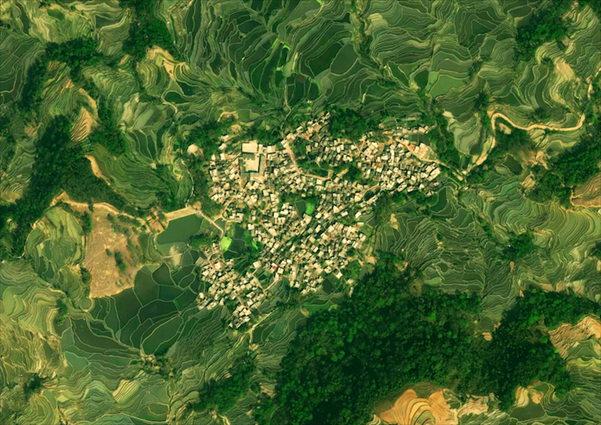
Aerial photo of 元阳麻栗寨. Photo by Zheng Xi.
Bazi(坝子)
“Bazi” refers to localized plains on the Yunnan-Guizhou Plateau, characterized by flat terrain, a mild climate, fertile soil, and convenient irrigation, making them core agricultural areas and densely populated urban centers. To ensure transportation in the mountainous regions of Southwest China, the Ming Dynasty established numerous military garrisons in these bazi, using the army to supervise local chieftains and maintain the stability and security of the frontier. However, as transportation in the mountains relied on mule caravans and human labor, large-scale goods transport was not feasible. Consequently, bazi in Yunnan became not only essential military bases and food supply centers for the army but also hubs for transportation and regional markets.
The study of bazi aims to gain a deeper understanding of the construction and evolution of society in the southwestern mountainous regions through this intersection of geography and society. Bazi serves not only as geographical plains but also as a window into social structures, revealing the interactions between local societies and the state system. We will next demonstrate how bazi tightly connects various regions in Yunnan, forming an interdependent and co-developing socio-economic network, showcasing its pivotal role as a core link in the process of regional integration.
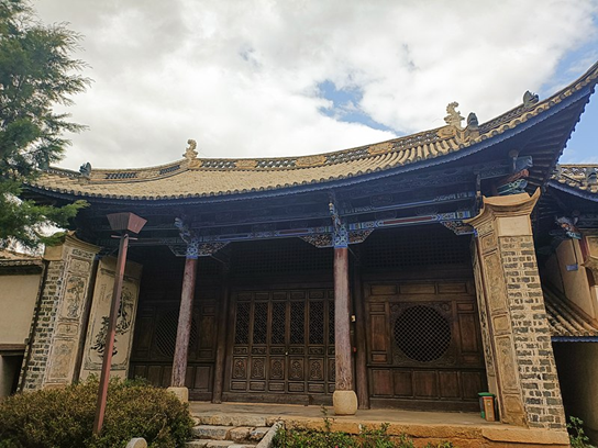
Post station古驿站(岗公祠).
Photo by Wikipedia User:Kcx36, January 23, 2024.
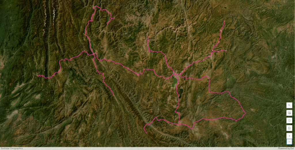
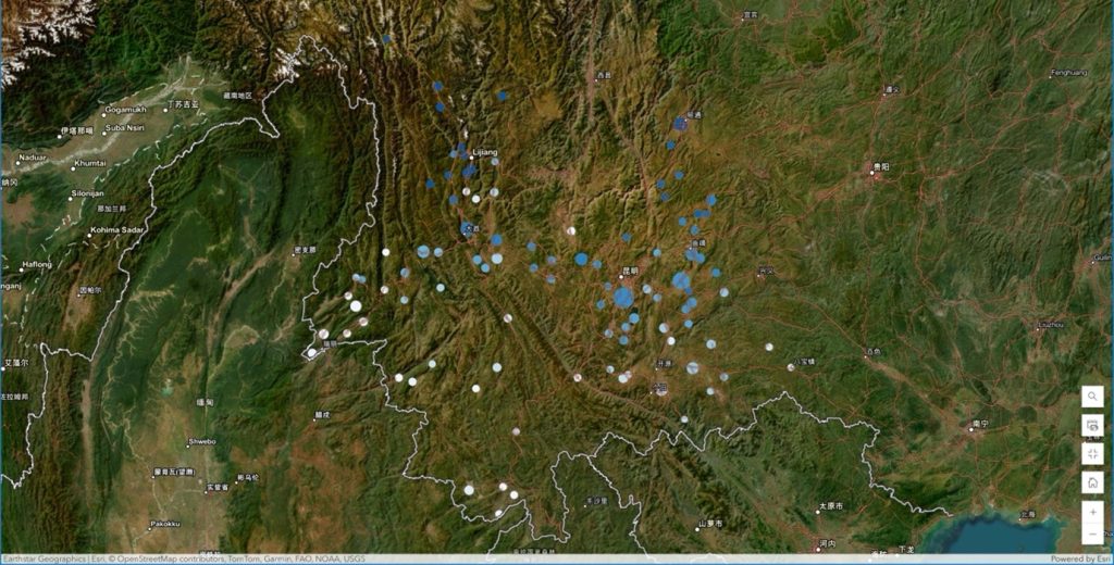
Marked based on the Map of Yunnan Province’s Post Roads and Post Stations in the 15th Year of the Wanli Reign of the Ming Dynasty
Post stations (驿站)
According to the “Collected Statutes of the Ming Dynasty”, (明会典)post stations and post roads had the functions of disseminating government decrees, swiftly reporting military intelligence, and receiving distinguished guests from all directions. After Zhu Yuanzhang established the Ming Dynasty, he established a very strict post road organization and management system with reference to the previous system. Not only set up post road transfer stations throughout the country, but also some new post roads were opened. Due to official maintenance, most post roads were flat and nearly straight, and the service facilities were relatively complete, so most merchants used post roads to travel from south to north for trade activities. In addition, since the Ming Dynasty, the relationship between Yunnan and the central dynasty has become increasingly tense, and the economic and cultural interactions between the people of all ethnic groups in Yunnan and the inland have continued to expand, so it has become the focus of the dynasties in setting up defense and control borders. Therefore, the Ming Dynasty took the opening of roads and setting up post stations in Yunnan as an important border fortress.
Words from Students
The process began with extensive research and data analysis. We gathered historical materials and organized the data effectively. This initial phase was crucial as it laid the groundwork for our GIS system. We learned to critically evaluate historical sources and understand their relevance to our project.
In addition to the research component, we faced the challenge of learning to use the ArcGIS system from scratch. This required us to familiarize ourselves with new software and tools, which was both exciting and daunting. Through hands-on practice and collaboration, we gradually became more proficient in using ArcGIS to visualize our findings.
Overall, this project has not only enhanced our technical skills but also deepened our understanding of the historical context of the Yunnan region. It has fostered teamwork and collaboration among us, allowing us to share knowledge and insights from our respective fields. We look forward to continuing our work and uncovering more about the historical geography of this fascinating area.
This experience has been invaluable, and we are grateful for the guidance of our professors and the opportunity to explore this unique intersection of history and technology.
LIN Hongcheng, Candace
Year 3, BEng in Electronic Engineering
WANG Yi Tina
Year 2, BSc in Global China Studies
WEI Zhifei
MPhil Student of Humanities
Project Team
- Prof. Jianxiong MA (Division of Humanities)
- Dr. Qiuzi GUO (Division of Humanities & Library)
- WANG Yi Tina (Student from Global China Studies)
- LIN Hongcheng (Student from Electronic engineering)
- WEI Zhifei (MPhil Student of Humanities)
References
- 《坝子社会:一种历史人类学的视角》Author :寸云激,马健雄
- 《云南省志》Publishing Unit :云南省地方志编纂委员会
- 《云南坝子研究》Author :童邵玉,陈永森
- 《中国历史地图集》Publishing Unit : 中国地图出版社
- 《明代驿递制度》Author:苏同炳