
26 Spring / Digital Humanities Seed Grant Project
Principal Investigator: Dr. Marco CABOARA
Mapping Tartary:
A Digital Exploration of European Cartography
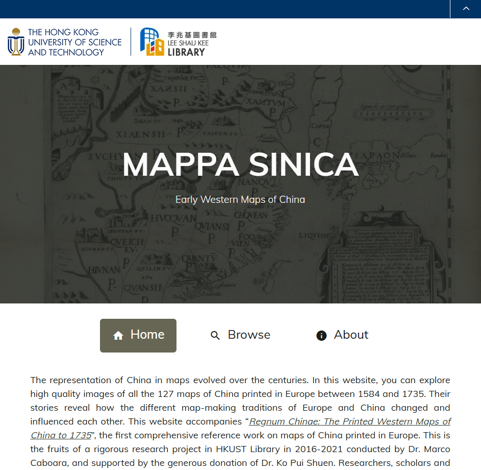
The cover is the Tartary map from HKUST Library Special Collections.
Project Background
From the rise of the Mongol Empire in the 13th century to the 18th-century expansion into Xinjiang by the Qing dynasty, “Tartary” was the general term Europeans used to describe the vast and largely unknown territories of Central Asia, while “Tartars” referred to the peoples inhabiting that region. For centuries, a great deal of confusion surrounded the actual places and peoples of this part of the world among European observers. The information that filtered back to Europe was primarily gathered, processed, and disseminated through the commercial and knowledge centers of the Netherlands and Italy. Beginning in the late 16th century, this information was visualized in printed maps and atlases, which became the principal means by which Europeans came to understand Central and East Asia until direct and regular contact became prevalent towards the end of the 18th century.
The Hong Kong University of Science and Technology (HKUST) holds a unique collection of European maps of China and Tartary. While considerable scholarship exists on the history of European maps of China — most recently surveyed in the Principal Investigator’s monograph Regnum Chinae: The Printed Western Maps of China to 1735 (Brill, 2022) — there is a notable absence of comprehensive studies focused specifically on Tartary. The cartographic representation of Tartary from the 16th to the 18th centuries offers a singular lens through which to examine historical perceptions of geography, culture, and imperial power.
This project aims to develop a digital platform that will enable scholars, students, and the general public to explore and analyze the evolving representations of Tartary in European maps. By utilizing Digital Humanities methodologies, the project will build an interactive repository housing high-resolution map images alongside contextual information, analytical tools, and visualization capabilities. The platform is modeled on the website accompanying the Regnum Chinae book (Mappa Sinica) and will extend its framework with new features tailored to the study of Tartary.
The platform will also serve as a teaching resource for HUMA courses currently offered at HKUST, including “Marco Polo and the Silk Road,” “China in Maps,” and “History of Explorations.”
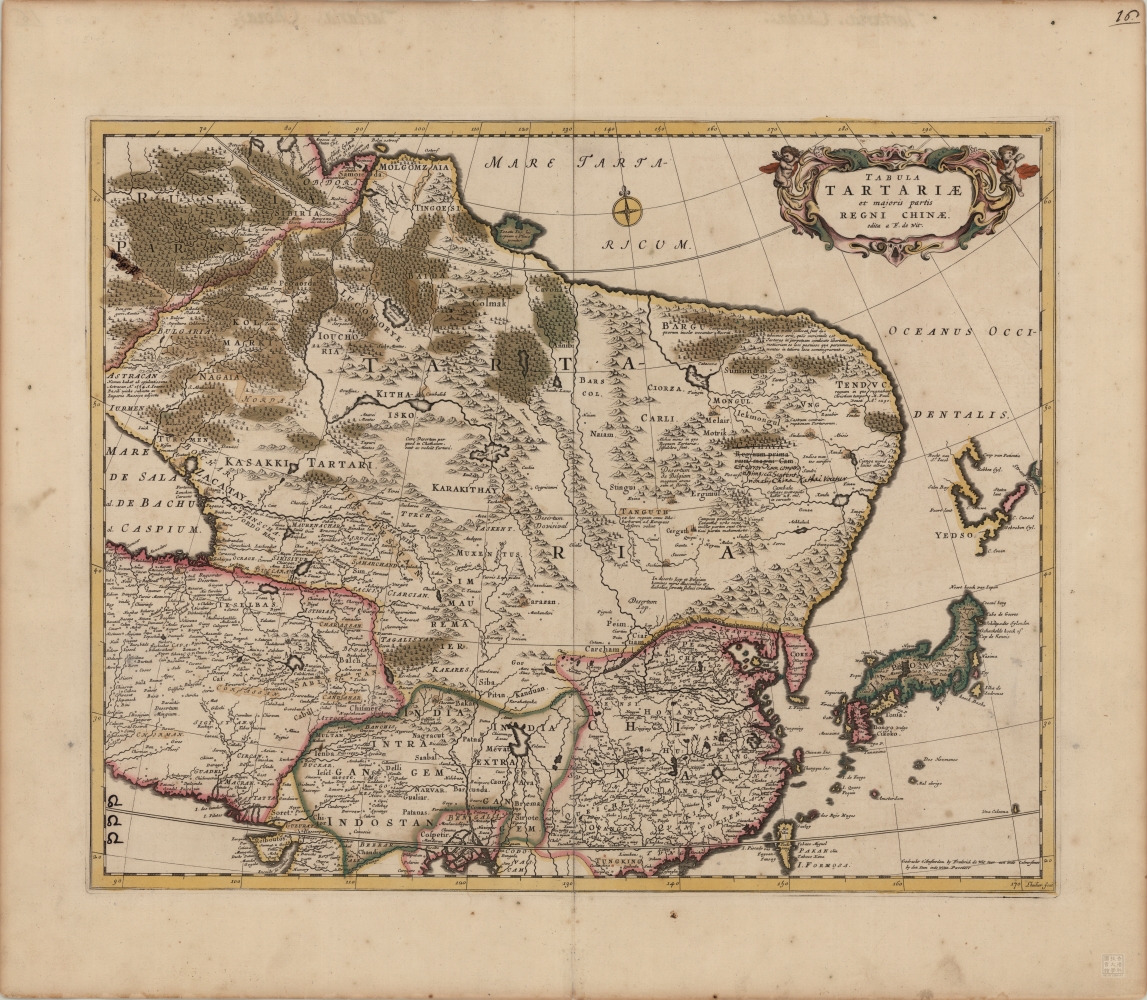
The Tartary map from HKUST Library Special Collections.
Project Objectives
- Build a digital repository of European maps of Tartary printed between the 16th and 18th centuries, beginning with maps held at HKUST and supplemented by materials from open-access collections such as the Library of Congress and the David Rumsey Map Collection at Stanford, as well as partner institutions including the Amsterdam University Special Collections and the French National Library.
- Develop new analytical features beyond those offered in the Mappa Sinica website, including the visualization of European printing locations, networks of relationships between maps, and placename identification.
- Conduct GIS analysis of selected maps of Tartary, producing detailed annotations that allow scholars to interrogate spatial accuracy, cartographic borrowings, and the evolution of geographic knowledge.
- Establish a foundation for international collaboration, connecting the project with an ongoing carto-bibliographic volume and conference on Tartary co-developed with La Sapienza University in Rome, intended as a companion to Regnum Chinae.
Milestones (Seed Grant Phase)
- A fuller list of European maps of Tartary, with at least 30 maps published online with metadata and standard descriptions.
- Detailed annotation and GIS analysis of at least one representative map of Tartary.
- Public preview of the website framework, designed to scale into a comprehensive research platform.
Principal Investigator
Dr. Marco CABOARA (Division of Humanities)
Student Assistants
Shutong YIN (Year One Undergraduate Student in Global China Studies) — research on maps, publication history, and placename identification
Tze Nam TSANG (Year Four Undergraduate Student in Global China Studies) — website development, image acquisition, GIS analysis
Project Support
Dr. Steve MA (Division of Humanities)
Yifan WANG (Library)
Project Team
Resources & Related Publications
- Caboara, Marco. Regnum Chinae: The Printed Western Maps of China to 1735. Leiden: Brill, 2022.
- Mappa Sinica — companion website to Regnum Chinae, developed at the HKUST Library.
- Gorshenina, Svetlana. L’invention de l’Asie Centrale: Histoire du Concept de la Tartarie à l’Eurasie. Genève: Librairie Droz, 2014.
- HKUST Library Special Collections — European maps of China and Tartary, featured in exhibitions held in 2017 and 2023.
- UNUS — La Sapienza University, Rome — collaborative cartographic platform.
- Partner collections: Library of Congress, David Rumsey Map Collection (Stanford), Amsterdam University Special Collections, British Library, French National Library (BnF).